Skip to main content
Livraison gratuite dès
100 €*
Retour gratuit sous
100 jours
Conseils d'experts
Prendre rendez-vous
Contactez-nous
FAQ
04 85 21 31 82
Me connecter
Accès
Me connecter
Mot de passe oublié
Vêtements
Chaussures
Randonnée
Trail-Running
Escalade
Vélo
Hiver
Activités
Seconde main
Marques
Soldes
Magazine
Conseils d'experts
Soldes d'été 🔥 -5 % EXTRA dès 2 produits* code Summer5
Marques
IGN
IGN
(322 Résultat)
Trier par
Préférés
Nouveautés
Du moins au plus cher
Du plus au moins cher
Promos
Filtrer
(0)
322 Résultats
Trier par
Filtrer
Genre
Homme
Femme
Marques
IGN
Recommandé pour
Randonnée
Trekking
Voyage
Prix
0€ - 25€
Taille
One Size
Dimensions
96 x 132 cm
132 x 99 cm
96 x 132 cm
96 x 132 cm
96 x 132 cm
96 x 132 cm
Voir 3 de plus
Promotion
10% - 20%
20% - 30%
Trier par
Préférés
Nouveautés
Du moins au plus cher
Du plus au moins cher
Promos
IGN
Mont Salève. St-Julien-En-Genevois - Carte topographique
13,20 €
IGN
Port-Saint-Louis Du Rhône - Carte topographique
13,20 €
IGN
Saint-Girons.Couserans - Carte topographique
13,20 €
IGN
Landerneau. Landivisiau - Carte topographique
13,20 €
IGN
Cervione.Pnr De Corse - Carte topographique
13,20 €
IGN
Aix En Provence / Vitrolles / Lambesc - Carte topographique
13,20 €
IGN
Castets / Lit Et Mixte / Léon - Carte topographique
13,20 €
IGN
Forêt De Bord - Louviers - Carte topographique
13,20 €
IGN
Pointe Du Hoc Omaha Beach - Carte topographique
13,20 €
IGN
Vézénobres / Moussac - Carte topographique
13,20 €
IGN
Cap Corse - Carte topographique
13,20 €
IGN
Ile-D'Oléron - Ile-D'Aix - Carte topographique
13,20 €
IGN
Pontarlier.Levier-Lac De St-Point - Carte topographique
13,20 €
IGN
Le Lamentin.Presqu'Île De La Caravelle.Pnr De Martinique - Carte topographique
13,20 €
IGN
Saint-Nazaire / Pornic - Carte topographique
13,20 €
IGN
Ile D'Ouessant / Le Conquet - Carte topographique
13,20 €
IGN
Bayonne - Anglet - Biarritz - Carte topographique
13,20 €
IGN
L'Île Rousse.Pnr De Corse - Carte topographique
13,20 €
IGN
Cavaillon / Fontaine De Vaucluse / Pnr Du Luberon - Carte topographique
13,20 €
IGN
Huelgoat / Montd D'Arrée / Pnd D'Armorique - Carte topographique
13,20 €
IGN
Épinal.Bruyères.Vallée De La Moselle - Carte topographique
13,20 €
IGN
Fécamp / St-Valery-En-Caux - Carte topographique
13,20 €
IGN
Mimizan / Lac D'Aureihan - Carte topographique
13,20 €
IGN
Macon Cluny Roche De Solutré - Carte topographique
13,20 €
IGN
Pézenas / Murviel-Lès-Béziers - Carte topographique
13,20 €
IGN
Haut Estéron / Préalpes De Grasse / Pnr Du Verdon - Carte topographique
13,20 €
IGN
St-Dié-Des-Vosges.Senones.Fraize - Carte topographique
13,20 €
IGN
Wissembourg.Lauterbourg-Soufflenheim - Carte topographique
13,20 €
IGN
Meaux.Vallée De L'Ourcq - Carte topographique
13,20 €
IGN
Champagnole.Lac De Chalain.Pic De L'Aigle - Carte topographique
13,20 €
IGN
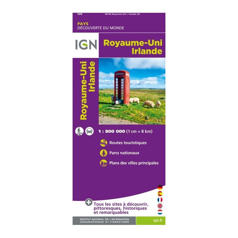
Royaume-Uni / Irlande - Carte topographique
6,80 €
IGN
Rochefort / Marennes - Carte topographique
13,20 €
IGN
Saumur / Bourgueil / Fontevraud-L'Abbaye - Carte topographique
13,20 €
IGN
Gorges Du Tarn Et De La Jonte.Causse Méjan.Pn Des Cévennes - Carte topographique
13,20 €
IGN
Le Touquet-Paris-Plage.Berck.Vallée De La Canche - Carte topographique
13,20 €
IGN
Brest / Pointe De Saint Mathieu - Carte topographique
13,20 €
IGN
Lyon / Villeubanne / Mont D'Or - Carte topographique
13,20 €
IGN
Mantes-La-Jolie / Boucles De La Seine / Pnr Du Vexin Français - Carte topographique
13,20 €
IGN
Les Sables-D'Olonne - Carte topographique
13,20 €
IGN
Rumilly - Carte topographique
13,20 €
IGN
Arc-Et-Senans.Quingey-Vallées De La Loue Et Du Lison - Carte topographique
13,20 €
IGN
Porto.Calanche De Piana.Pnr De Corse - Carte topographique
13,20 €
IGN
Lamentin - Basse Terre - Carte topographique
13,20 €
IGN
Sète Cap D'Agde.Étang De Thau - Carte topographique
13,20 €
IGN
Quillan / Alet Les Bains - Carte topographique
13,20 €
IGN
Gorges Du Verdon - Carte topographique
9,90 €
IGN
Montpellier.Palavas-Les Flots - Carte topographique
13,20 €
IGN
Caen / Ouistreham - Carte topographique
13,20 €
IGN
Camarès / Avène - Carte topographique
13,20 €
IGN
Saint-Maximin-La-Sainte-Baume / Barjols / Trets / Mont Aurelien - Carte topographique
13,20 €
IGN
Val Suzon - Carte topographique
13,20 €
IGN
Sarrebourg.Phalsbourg.Pays Des Etangs - Carte topographique
13,20 €
IGN
Haguenau.Lembach.Pnr Des Vosges Du Nord - Carte topographique
13,20 €
IGN
Corniche Des Cévennes.Parc National Des Cévennes - Carte topographique
13,20 €
IGN
Bourg-Argental.Col De La République.Pnr Du Pilat - Carte topographique
13,20 €
IGN
Thuir - Ille-Sur-Têt - Carte topographique
13,20 €
IGN
Oyonnax.Gorges De L'Ain.Pnr Du Haut Jura - Carte topographique
13,20 €
IGN
Provence / Ste Victoire / Ste Baume / Calanque - Carte topographique
9,50 €
IGN
Forêt De Mormal - Carte topographique
13,20 €
IGN
Belfort-Montbéliard - Carte topographique
13,20 €
1
...
3
4
5
6
Nos marques de chaussures, vêtements et matériel
Patagonia
Ortovox
Rab
La Sportiva
Lowa
Altra
Millet
Moon boot
Helly Hansen
Barbour
Fjällräven
Columbia
Scarpa
Vaude
Mammut
Julbo
New balance
Hanwag
Birkenstock
Petzl
Chaussures, vêtements et matériel : plus de catégories
Doudounes femme
Parkas femme
Polaires femme
Doudounes homme
Parkas homme
Polaires homme
Tentes
Matelas de randonnée
Lampes frontales
Sacs de couchage
Réchauds
Sacs à dos randonnée
Piolets
Chaussures de randonnée
Chaussures de trail
Chaussures de running
Chaussons d'escalade
Chaussures randonnée enfant
Casques vélo
Porte-bébés randonnée
Vêtements enfant
Polaire enfant
Bottes de pluie Aigle enfant
Polaires Patagonia
Doudounes Pyrenex
Vestes Helly Hansen
Polaires Columbia
Lampes frontales Black Diamond
Chaussures Meindl
Sacs à dos Dakine
Cuissards Assos
Casques Giro
Doudounes Rab
Harnais chien
Laisses chien
Sacoches vélo Ortlieb
Chaussures Altra
Tours de cou Buff
Casques vélo Abus
Doudounes Patagonia